 |
| Plaque describing how Schoodic Peninsula became public |
Many people who visit Acadia National Park in Maine never leave Mount Desert Island where the largest part of the park is located. These people are missing out. There are also sections of the park on Schoodic Peninsula and on Isle au Haut . Schoodic Peninsula is the land you can see across Frenchman Bay from Bar Harbor . It is easy to get to and I will be describing all four hiking trails located there, as well as the drive on the one-way park loop road that is located there.
Directions – Drive off Mount Desert Island via Route 3 back into Ellsworth. When you reach Route 1 take it east. Drive until you reach West Gouldsboro . Take Route 186 south to Winter Harbor Acadia National Park Mount Desert Island . After 2-3 miles on this road you will see a two way road to the right that leads to Schoodic Point. Take this to the end and park for some great views. There is a bathroom here, located to the left of the parking area.
 |
| People enjoying the sun at Schoodic Point |
 |
| Surf at Schoodic Point |
 |
| Surf at Schoodic Point |
When you are done with the views here, drive back to the one way road and turn right onto it. In about .5 miles there will be a sign on the right for the Blueberry Hill Parking area. Pull in here for the hiking trails. There is no bathroom or drinking water here.
 |
| View from the road at the Blueberry Hill Parking area |
I am going to describe each of the four trails separately, and then I will describe a single loop hike that will take you to all the best features of each.
Alder Trail and Schoodic Head Trail: Although technically separate trails they really combine into a single trail that summits Schoodic Head. Walk up to the road from the Blueberry Hill Parking area. Right across from the parking entrance is the start of Alder Trail. This rises very gently on a grassy abandoned road. In .6 miles you will come to a dirt road. Continue straight for .1 miles to the Schoodic Head Trail. It will be on the right. Schoodic Head Trail is another .7 miles to the summit of Schoodic Head. It rises somewhat moderately over roots and rocks. Just before the summit are good views to the west. (It was too cloudy to get any pictures to share.) It took me 40 minutes to go the 1.4 miles with a 400 foot elevation change.
 |
| Alder Trail |
 |
| Just a few roots to walk over on the Schoodic Head Trail |
Anvil Trail: Walk up to the road from the Blueberry Hill Parking area. Turn right and walk up the road about a tenth of a mile. The trailhead will be on the left. This trail has a series of small rises over rocky upthrusts, followed by small descents. For more than half the 1.1 mile distance not much net elevation is gained. At .3 miles from the start watch for a sign on the left to take a short side trip to “The Anvil”. This is an overlook for Schoodic Point. When you are done here retrace your steps to the Anvil Trail and turn left to continue. Most of the 400 foot elevation gain to Schoodic Head is done in the last portion of this trail. Because of the ups and downs prior to this last rise, this trail features the largest total elevation change.
 |
| View of Schoodic Point from The Anvil |
East Trail: This is the steepest of the four trails, although it is also the shortest at .5 miles to the summit. There is a great overlook near the summit. You can park at the trailhead for this by pulling off the side of the one way road .9 miles past the Blueberry Hill Parking area.
 |
| View of Spruce Point from the scenic overlook on East Trail |
Recommended hike to combine the best of all trails: Unlike the bare mountain tops on the east side of Mount Desert Island , Schoodic Head is wooded enough that there are no views from the actual summit. Instead the views are at locations on each of the three trails. This hike will take you to each of these views, and includes a scenic walk on part of the one way road.
Walk up to the road from the Blueberry Hill Parking area. Turn right and walk up the road about a tenth of a mile. Take the Anvil Trail left off this road. In .3 miles you will see a sign for “The Anvil”. Take this short side trip for a view of Schoodic Point. When you are done return to the trail and continue all the way to the summit of Schoodic Head. From here take the Schoodic Head Trail a short distance to great views of Mount Desert Island .
When you are done here, return to the summit and this time take the East Trail. In a short distance there will be a sign on the left for a scenic overlook. Take this path about .2 miles to 180 degree views from Mount Desert Island to the west through the Spruce Point peninsula to the east. When you are done here, return to the East Trail. Turn left and descend somewhat steeply at first, then moderately to the one way road. Turn right and walk back .9 miles a little uphill to the Blueberry Hill Parking area. There is no separate walking trail like the Ocean Trail beside the Park Loop Road in the main part of the park, but the traffic here is much lighter and can easily switch to the left lane of the road. It is also grassy beside the road and you can step off it easily, if you wish. In fact, I spent time exploring down onto rocks along the way back. I also enjoyed the views more because I was traveling the road much slower than in a car.
 |
| Rolling Island just off the coast of the Schoodic Peninsula |
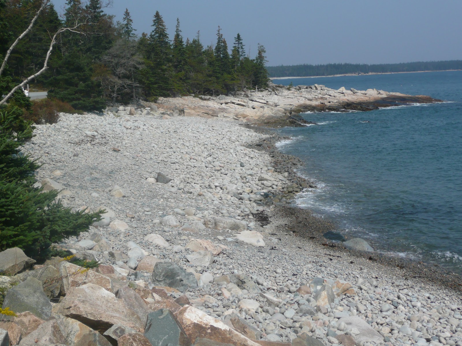 |
| Rocky beach opposite Rolling Island |
 |
| View of a beach and small peninsula on the walk back to the Blueberry Hill Parking area |
 |
| Large birds (ducks? terns?) cleaning their feathers |
After you have finished all the hiking you want to do, drive back to the one way road and turn right. Continue for another couple miles and the road becomes two way. It will then connect to Route 186. Turn left onto this and drive back through
Recommended hike:
Cumulative distance: 3.1 miles round trip
Cumulative elevation gain: 600 feet
Cumulative duration: 1 hour 45 minutes
Eiders...maybe...not terns..too plump for a tern...look more duck like!
ReplyDeleteThanks for the tip, especially since they are small in the picture. The close up picture I took of them was unfortunately blurry so I did not include it here.
DeleteWe did it, and thank you for your well done detailed descriptions. We followed it and your distance calculation matched ours. We had a great time.
ReplyDeleteYou're welcome. I'm glad I was able to be of help to you.
DeleteDo you know if Schoodic is still accessible with the shutdown?
ReplyDeleteUnfortunately, I believe it is closed off. While there is no guard gate there like with the Park Loop Road in the main part of Acadia National Park, it is my understanding that all of the park's roads have had barriers placed across them to prevent entry. This is to prevent people from accessing the park and then needing medical help which cannot be provided and/or to prevent possible vandalism by people entering the park.
DeleteIf you are in the Bar Harbor area and looking for a scenic drive, you can still travel around Mount Desert Island itself on Route 3, as well as some roads off of it, like Sargent Drive north of Northeast Harbor, that can give you ocean views. And the western part of the island has Routes 102 and 102A that give you some views. There is also the peninsula to the west of Mount Desert Island which you can drive around via Route 175. (The views are not as good, though.)
Finally, you could also try a loop northeast of Ellsworth. Go back into that town and take 1A north for a bit, Turn right onto Routes 179 and 180, then bear right again to stay on Route 180 when they split. This takes you up the eastern side of Graham Lake. When you come to Route 200, turn right to take it. As you come down Route 200, if the sky is clear, you get a great view of the various mountains on Mount Desert Island silhouetted against the ocean and sky. When you reach Route 1, turn right to head back towards Ellsworth to complete the loop.
And if you are looking for hiking outside of the park, there is always Tunk Mountain. I have not hiked it yet myself, but it is supposed to have good views. You can reach the trailhead for it as part of the loop I just described. While coming down Route 200 it merges with Route 182. When they split again turn left to follow Route 182 east. Aproximately 5-10 miles after this you will see signs for Tunk Mountain. There will be a large parking area on the left for the start of the trail. There is a bathroom there. I can't remember if there was drinking water.
Good luck!