 |
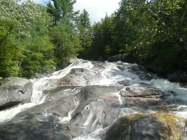
| Step Falls |
Specific Directions (see General Directions in the Grafton Notch header post here): Drive about 5 miles up Route 26 from Route 2. Look for a small sign on the right that says “Wight Brook”. It is right before a section of metal guardrail on both sides of the highway. If you reach the state park you have missed the turn.
Note: the Wight Brook turn off on the right usually has a large puddle near the entrance. Unless you have a low to the ground sports car you should be okay to drive through it. You will find parking for 8-10 vehicles. There are no bathrooms or drinking water here.
The trail head is at the end of the parking area away from the road. It is a wide, well maintained trail. It runs flat for a couple tenths of a mile before coming to the stream. From this point there are multiple, worn trails upstream to the falls. The official one has yellow blazes on the trees. All trails from this point have some hiking over roots, so watch your step.
You will come to your first sight of some small falls just after meeting the stream. This is just a taste of what is to come. Go a little further upstream and you finally see a large section of Step Falls
 |
| At the bottom of Step Falls |
You can continue to make your way upstream to the top of the falls. There are openings where you can get out onto the rocks in the midst of the falls, but watch your footing. The rocks can get slippery.
 |
| Midway up Step Falls |
 |
| Looking down from the top of Step Falls |
There are small signs that warn about the Preserve boundary. They close in on the falls at an angle, so you can still make your way to the top of the falls by angling closer to the stream. The final boundary sign is right at the top and at this point you can go no further.
I have seen some people just sitting on the rocks, relaxing. I’ve seen some people bring a picnic lunch with them. I’ve even seen some kids swimming in a pool in the falls when the water was not running that fast. You will likely encounter other people when you visit.
When you are done sightseeing, turn around and head back the way you came. If you are ever unsure which of the worn trails to take, look for the yellow blazes, or just walk parallel to the stream.
Cumulative distance: less than a mile
Cumulative elevation gain: less than 200 feet
Cumulative duration: 30-60 minutesMaine Mountain Guide
No comments:
Post a Comment