 |
| View from the summit of Norumbega Mountain |
Directions: Take Routes 3 and 198 north out of Northeast Harbor. Just after passing the end of Upper Hadlock Pond, which will be on the right, there will be a small parking area on the left off the side of the road. Since this is also the trailhead for several trails to Parkman Mountain, Bald Peak, and others, there may be cars also lined up along the side of the road. The trailhead for Norumbega is on the same side as the parking, at the north end of the lot.
The hike starts on The Goat Trail. You will soon see that it is aptly
named. It rises 600 feet in a quarter of
a mile. In fact, almost all the
elevation gain for this part of the hike is achieved in just this short
starting section. If you are part
mountain goat it will help you to get up over the many steps and
switchbacks. In fact, at one point I
passed a mountain goat that had stopped and was sucking wind.
All kidding aside, while this section of the trail certainly
presents a physical challenge, I’ve encountered worse. The East Royce Trail on the Maine/New
Hampshire border comes to mind.
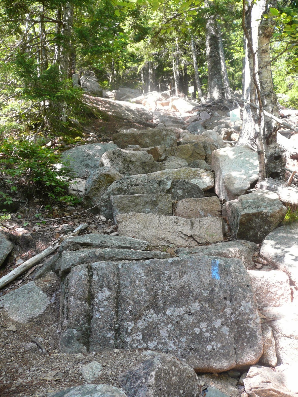 |
| A sample of what you will encounter on the Goat Trail |
 |
| The upper end of Somes Sound as seen from the Goat Trail |
 |
| The mountains to the east of Norumbega as seen from the Goat Trail |
You will come to a large pile of rocks with a trail sign in
it. This does not mark the actual
summit. As you stand and read the trail
signs turn 180 degrees and up behind you, partially hidden by some short trees
is another pile of rocks with the sign for the true summit. There are no real views from the summit. The surrounding trees, although short, block
most of the sightlines in all directions.
Go back to the trail sign and continue on what is now named
the Norumbega Mountain Trail. Note: in
the hiking guide A Walk in the Park it is labelled Shady Hill Trail. This drops very easily for a while. Every now and then there are hints of views
in various directions, but at no point is there a truly unobstructed view.
 |
| The Cranberry Islands as seen coming down the Norumbega Mountain Trail |
 |
| St. Sauveur Mountain on the other side of Somes Sound |
You will now start to drop a little quicker and encounter a
couple of moderate descents. The trees
start to get bigger and pine needles with bare ledge underneath becomes
prevalent. Watch your footing in wet
conditions. As the trail continues to
drop to Lower Hadlock Pond it becomes true forest hiking, with mature trees all
around.
 |
| Mixture of old and new fir trees lining the trail |
 |
| Looking northeast across Lower Hadlock Pond from the Hadlock Ponds Trail |
 |
| The small waterfall at the upper end of Lower Hadlock Pond |
 |
| Looking back from above the waterfall |
This last nine tenths of a mile presents the roughest
footing of the entire hike. The trail features
a seemingly endless supply of roots to step on and over. It rises easily, although it gains more
elevation than I had been expecting. It
also has a short section where it loses some elevation. At some point there is supposed to be a
connector to another parking area on Routes 3/198, but I passed it without
spotting it. It apparently did not have
a trail sign.
All along this trail you can hear the sound of traffic on
Routes 3/198, but it is hidden from view by the surrounding trees. This trail probably exists to allow hikers to
get back to the starting point of the Goat Trail without having to walk a half
a mile or more on the highway, but considering the traffic noise comes through
anyway, and considering the bad footing, I almost wonder if it would have been
easier just to walk the highway.
Consider this: The
entire traverse of Norumbega from start to reaching the shore of Lower Hadlock
Pond is 1.8 miles. It took me less than
1.5 hours to do this, and that’s with more than a half an hour spent on just
the first quarter mile. The walk back on
mostly level trails filled with roots and rocks is a distance of 1.5 miles and
it took me an hour. Leaving out the
steep rise at the beginning I made better time traversing the mountain than I
did walking over all the roots on the level trails.
Overall, I have to admit I was a little disappointed. I had read descriptions of much better views
on this hike, but I guess in the intervening years between when those were
written and the present the trees have grown enough to block most of the
views. I don’t regret doing this hike;
it’s just not one that’s going on my list of hikes to do again someday for the
sheer enjoyment of it.
Cumulative
distance: 3.3
miles
Cumulative elevation gain: 900 feet Cumulative duration: 2 – 2.5 hours (including time for photos)
No comments:
Post a Comment